back to SpaCE Lab Research Overview
Macrosystems Biology & Patterns of Biodiversity
Project 1: Biodiversity Patterns & Drivers Across Scales - Project Website: https://neon-biodiversity.github.io/


|
This NSF funded research includes a NSF EF EAGER-NEON award "Using Intraspecific Trait Variation to Understand Processes Structuring Continental-scale Biodiversity Patterns" (2015-2018), and a Macrosystems Biology award "Local- to Continental-Scale Drivers of Biodiversity" (2019-2024)). These projects utilize National Ecological Observatory Network (NEON) data on intraspecific trait variation, additional measurements from NEON organismal samples, and data related to NEON sites and samples (e.g., phylogenetic community structure) to determine how assembly processes internal to communities (e.g., biotic interactions, microenvironmental heterogeneity) and large-scale assembly processes external to communities (e.g., climate, land use, disturbance) combine to affect intraspecific trait variation and community structure across the continental United States.
Monitoring shifts in trait variation and can help detect species-level and community-level responses to disturbances, climate and land use change, and invasive species.
|
Project 2: bioXgeo (Connecting Biodiversity, Geodiversity, and Remote Sensing across Scales)
|
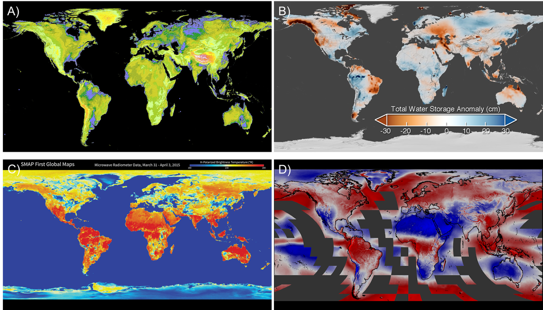
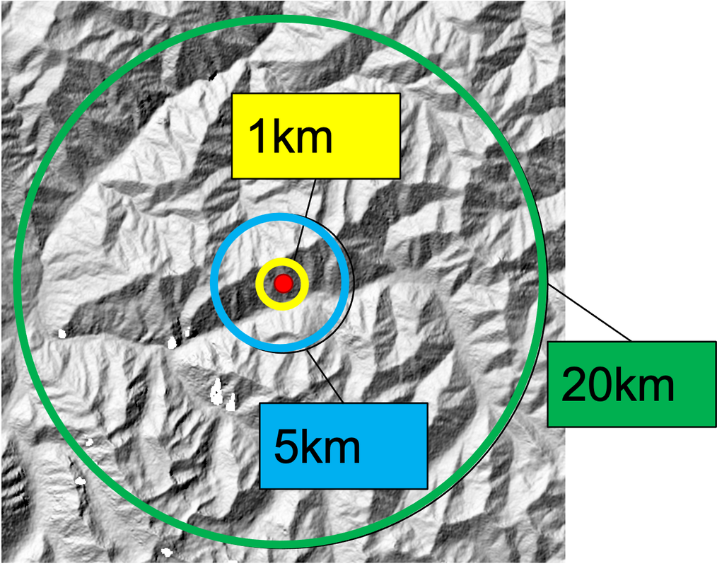
Geodiversity is the variation in abiotic features and processes on Earth's surface. This NASA funded Working Group brings together scientists and practitioners in biodiversity and remote sensing to address two main research questions:
(1) How do the relationships between biodiversity and geodiversity change across spatial scales? (2) What derived NASA data products at particular spatial or temporal scales would transform the use of geophysical data by biodiversity scientists and practitioners? Here is our Project Summary.
|
Project 3: Frugivoria: Biodiversity, Geodiversity, & Species vs. Functional Conservation
|
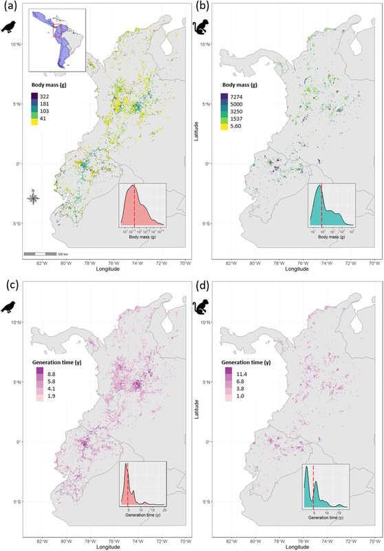
Cloud forests are biodiversity hotspots but climate change is altering cloud layer distribution and thickness. Many of the species residing in cloud forests are data deficient, making it challenging to apply traditional species distribution models. We are working to improve the conservation assessments of a data-deficient species in the Northern Andes by incorporating occurring and functionally similar species occurrence data. This project focuses on filling gaps in functional trait data for frugivores (i.e., through publishing the open access functional trait database, Frugivoria), and investigating the spatial patterns of functional diversity across the biodiverse Neotropics. A portion of this project also builds on the bioXgeo project to investigate the role of geodiversity in explaining species' distributions at varying spatial scales.
|
Project 4: aquaXterra (Aquatic & Terrestrial Linkages)
|
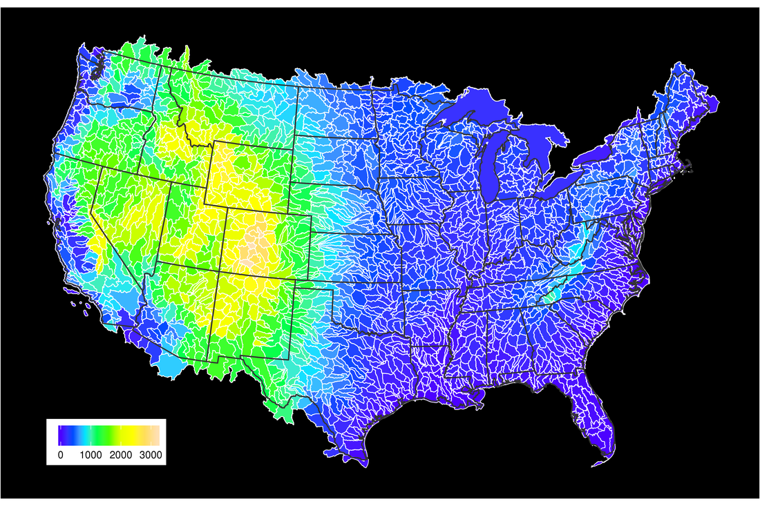
Quantifying linkages between biodiversity and productivity across aquatic and terrestrial realms—and how their relationship varies across spatial scales—is a needed area of research informing biodiversity-ecosystem functioning (BEF). Such investigations determine the spatial extent of interconnectivity of nutrient subsidies, species interactions and habitat use, as well as functional diversity among both realms. In combination with the LAke multi-scaled GeOSpatial and temporal database (LAGOS), we are integrating species occurrence, species trait, and satellite remotely sensed data across USGS Hydrologic Units with the goal of generating a publicly-accessible database.
Goals:
|
